1
View and inspect DXF
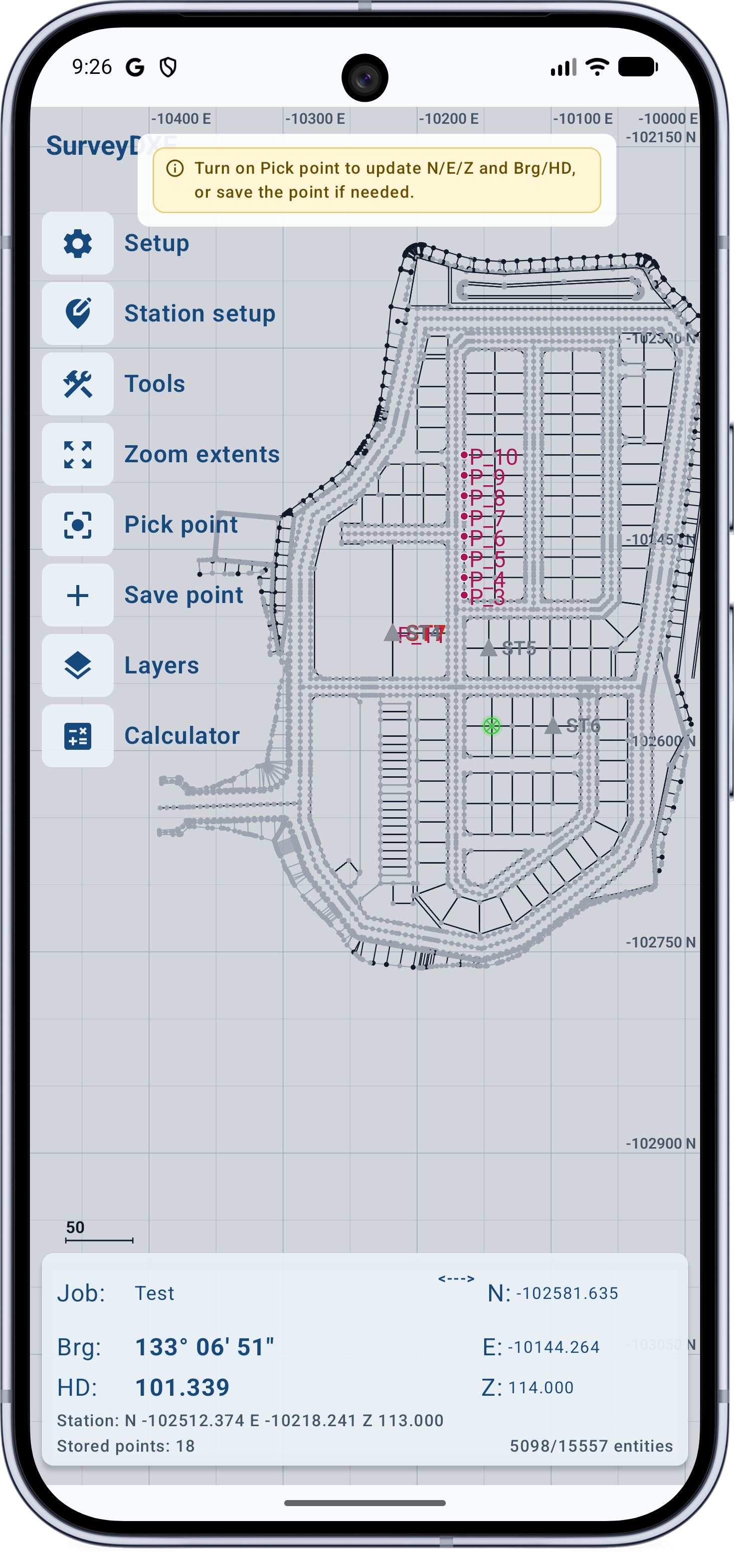
Seamlessly pan, pinch-zoom, and snap to CAD entities. Instantly read NEZ coordinates, bearings, and distances directly from picked geometry.
 SurveyDXF
Total station and theodolite field companion
SurveyDXF is the premier DXF field app for Android, designed to serve as the perfect companion for your Total Station and Theodolite setups. Instantly open DXF drawings, calculate NEZ coordinates, and determine bearings and distances directly on-site. Easily set occupied stations, stake straight lines or complex road curves, save your stakeout points, and export precise field records�all from your mobile device, eliminating the need to haul a heavy laptop to the field.
Streamlined Field Workflow
SurveyDXF focuses on the practical field loop: load the drawing, inspect geometry, set the occupied station, stake lines or curves, save stakeout points, record levels, and export the result.
Seamlessly pan, pinch-zoom, and snap to CAD entities. Instantly read NEZ coordinates, bearings, and distances directly from picked geometry.
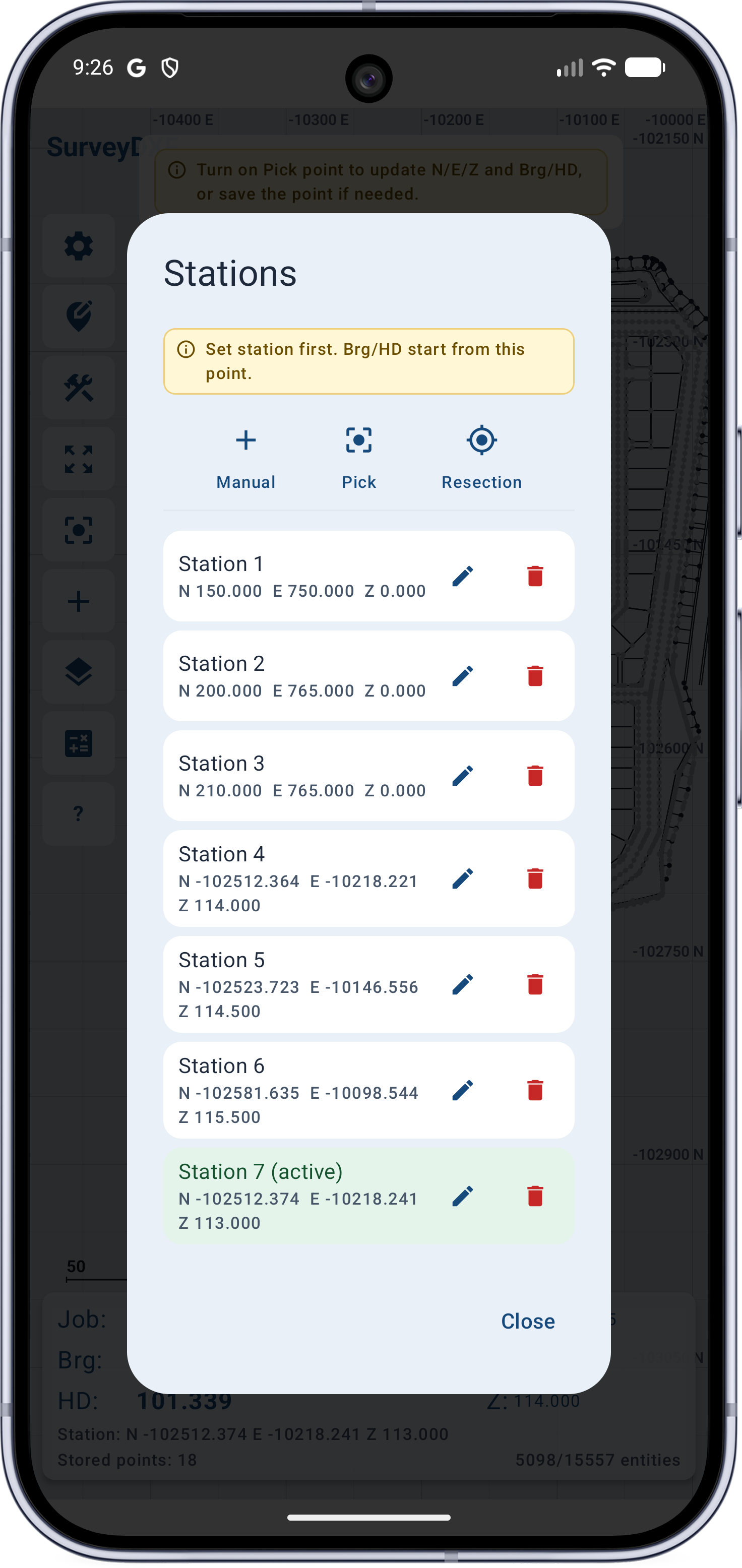
Set up your instrument position instantly. Input data manually, select a station visually from the drawing, or pick a saved point from your list.
Handle complex site geometry effortlessly. Stake straight lines, road curves, arcs, and circles with full support for curve length, radius, offsets, slope, and crossfall.
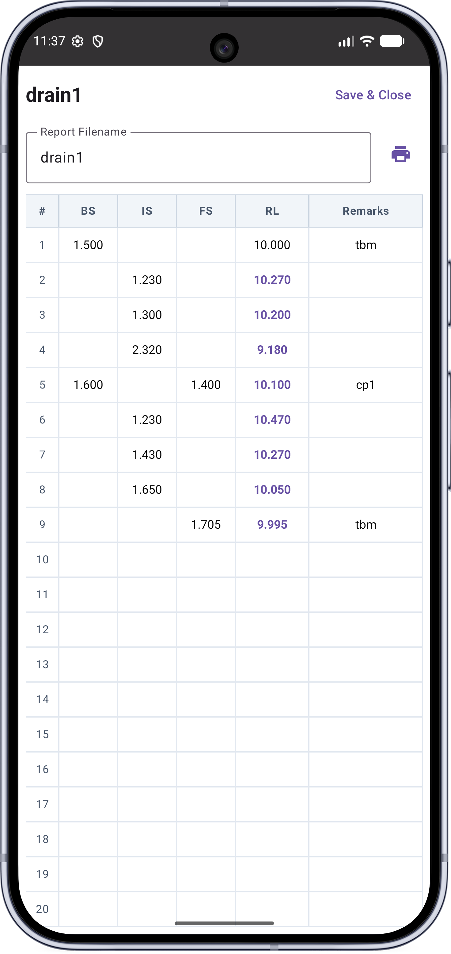
Ditch the paperwork. Record levelling observations directly in the app and export clean level-book records the moment the job is complete.
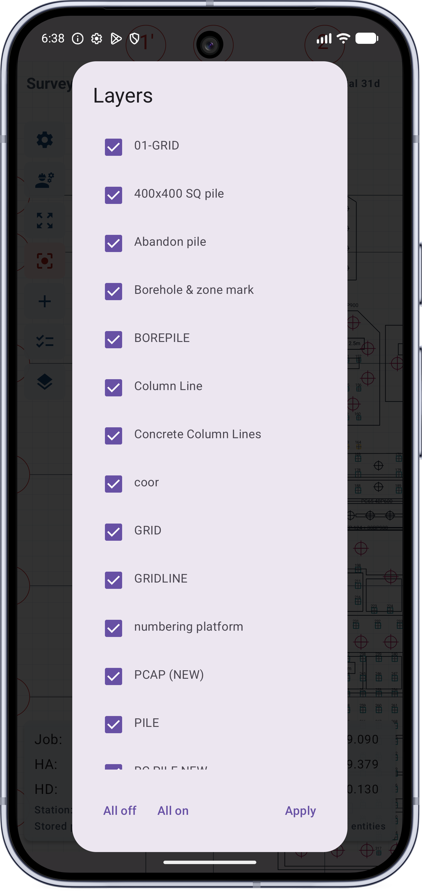
Maintain total clarity on crowded screens. Toggle dense DXF plans to show or hide layers, with your custom visibility settings saved automatically per drawing.
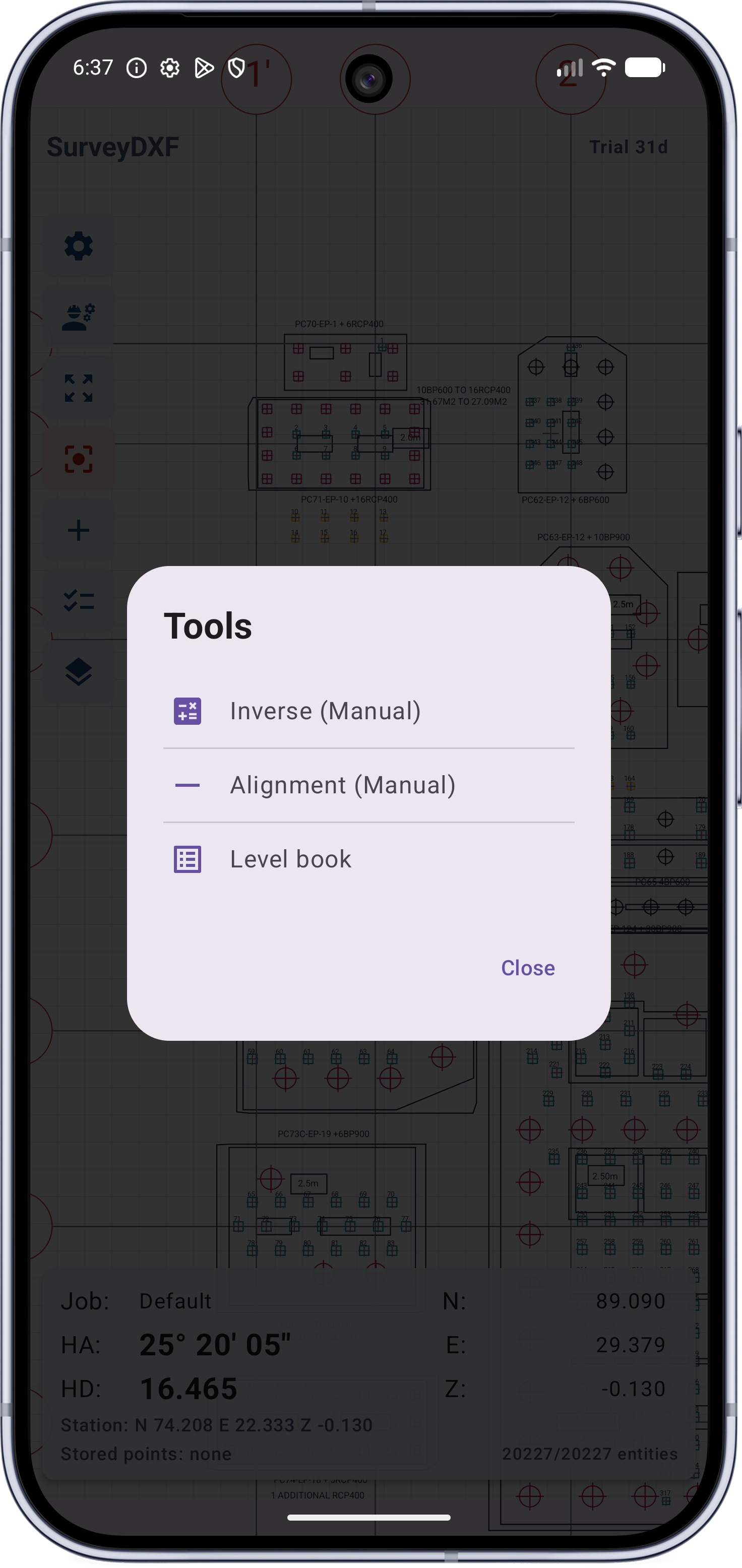
Use field calculations including arithmetic, height, inverse, forward, line, road curve, bearing, distance, offset, and alignment checks.
Advanced Engineering & Calculations
SurveyDXF focuses on the practical field loop: load the drawing, inspect geometry, set the occupied station, stake lines or curves, save stakeout points, record levels, and export the result.
Run comprehensive field coordinate geometry workflows on the spot. Seamlessly compute arithmetic, heights, inverses, forwards, offsets, and alignment checks without switching apps.
Calculate true astronomical azimuths instantly. Includes a built-in, full monthly almanac for rapid celestial data retrieval right at your setup point.
Key in design data exactly as it appears on paper. Input horizontal alignments and vertical curves directly from construction blueprints into the app without manual pre-conversion.
Sample Data Included: SurveyDXF comes pre-loaded with a built-in sample drawing so you can test features right away.
Companion Tools: Access external LISP tools (sdxf_*.vlx) using the unique lock code found directly inside your SurveyDXF app.
App screens
The interface keeps drawing controls, occupied station setup, COGO tools, line and curve stakeout, layer control, level book, and point lists ready for repeated site use.
Pick drawing geometry and review N/E/Z, horizontal angle, horizontal distance, bearing, line-stake, arc-stake, and circle-stake values.
Set occupied station values manually, pick from DXF geometry, or reuse saved station and point-list values.
Keep dense drawings readable by managing visible CAD layers on the device. Reopened drawings restore their own saved layer choices.
Calculate curve setout values in the field, then use graphical stakeout for DXF arcs and circles with radius and curve length shown for confirmation.
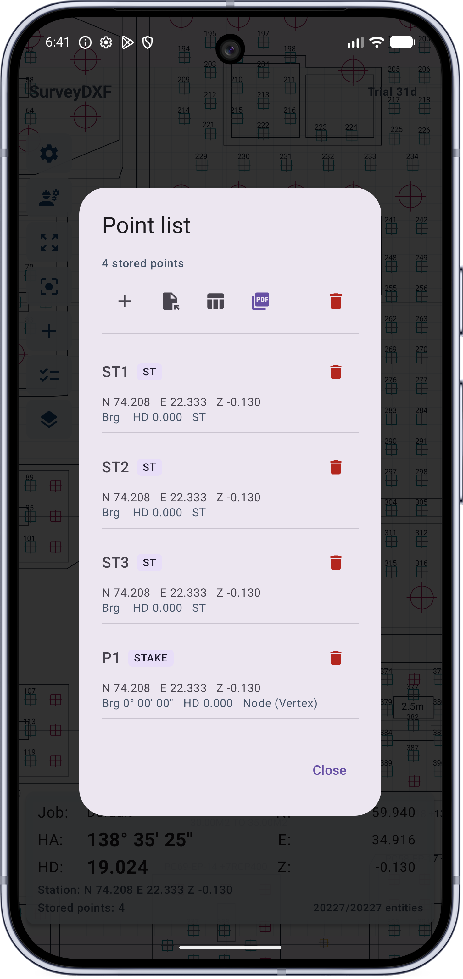
Review collected points and export the record after site work.
Record levelling observations electronically and export the field record after checking the job.
Downloads
SurveyDXF includes a built-in sample drawing in the app. Files listed here are optional external resources loaded from the generated downloads manifest.
Note: `sdxf_*.vlx` companion tools are opened with the lock code provided inside the SurveyDXF app.
SurveyDXF is aimed at field crews using total stations or theodolites who need quick access to geometry, station setup, COGO checks, and stakeout information on Android.
The page is focused only on SurveyDXF, the app workflow, and optional downloadable resources.
Contact developer
Send the developer your app version, Android version, phone model, and a short description of the drawing or workflow problem. For DXF problems, include the smallest sample file that shows the issue.
Use WhatsApp for quick field support, or email for files, screenshots, and longer bug reports.
Get started
Download the app from Google Play, then use the built-in sample DXF to check drawing navigation, coordinate readout, occupied station setup, COGO tools, line and road curve stakeout, level-book recording, layer control, and export behavior.